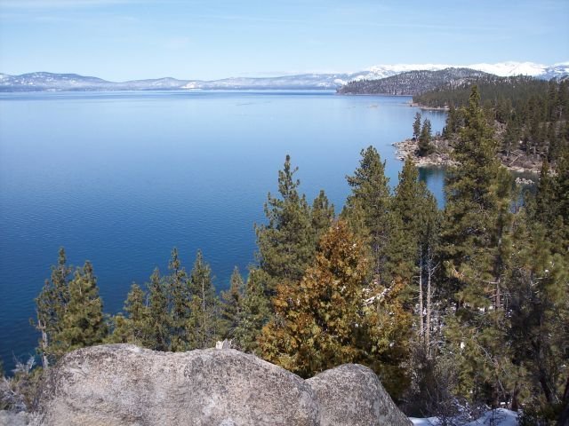
The Lake Tahoe Pacific Crest Trail represents a stunning 150-mile wilderness corridor traversing the Sierra Nevada mountain range, offering hikers an unparalleled journey through alpine landscapes, pristine wilderness, and breathtaking mountain vistas. Connecting Echo Lakes to Tuolumne Meadows, this trail segment challenges adventurers with elevation changes, diverse ecosystems, and spectacular panoramic views of the surrounding mountain terrain.
What Makes Lake Tahoe Pacific Crest Trail Unique?

The Lake Tahoe Pacific Crest Trail segment is a remarkable wilderness experience that combines geological diversity, ecological richness, and challenging terrain. Hikers encounter multiple ecosystems, from dense pine forests to alpine meadows, creating an immersive outdoor adventure.
Key Trail Characteristics
| Feature | Description |
|---|---|
| Total Length | Approximately 150 miles |
| Elevation Range | 7,600 – 11,000 feet |
| Primary Terrain | Mountain trails, alpine passes |
| Difficulty Level | Moderate to Challenging |
Where Can Hikers Access the Trail?

Echo Lakes Trailhead
- Location: Approximately 38.8342° N, 120.0643° W
- Parking: Large designated parking area
- Recommended for: Beginners and experienced hikers
Sierra City Trailhead
- Location: Approximately 39.5719° N, 120.6464° W
- Parking: Limited roadside parking
- Best for: Intermediate to advanced hikers
What Permits Are Required?
Hikers must obtain specific permits for different trail sections:
- Desolation Wilderness Permit
- Inyo National Forest Wilderness Permit
- Pacific Crest Trail Long-Distance Permit
How Challenging Are the Trail Conditions?
Trail conditions vary significantly based on seasonal changes:
- Summer (July-September): Most accessible, minimal snow
- Spring/Fall: Potential snow coverage, more challenging navigation
- Winter: Not recommended for hiking
Elevation Profile Highlights
The trail features dramatic elevation changes:
– Lowest Point: Echo Lakes (7,600 feet)
– Highest Point: Near Sonora Pass (11,000 feet)
– Total Elevation Gain: Approximately 3,400 feet
What Should Hikers Prepare?
Essential Gear Checklist
- Topographic maps
- GPS device
- Water filtration system
- Bear-resistant food containers
- Emergency communication device
- Layered clothing
- High-altitude hiking boots
What Wildlife Might Hikers Encounter?
The Lake Tahoe Pacific Crest Trail hosts diverse wildlife:
– Black bears
– Mule deer
– Mountain lions
– Various alpine bird species
– Smaller mammals like marmots and ground squirrels
How Can Hikers Stay Safe?
- Check weather forecasts before departure
- Inform someone about your hiking route
- Carry sufficient water and emergency supplies
- Understand basic wilderness first aid
- Follow Leave No Trace principles
What Are the Best Times to Hike?
- Peak Season: Mid-July to early September
- Recommended Months: August and early September
- Avoid: Late fall through early summer due to snow conditions
Additional Trail Resources
- Pacific Crest Trail Association
- US Forest Service websites
- Local ranger stations
- Online hiking forums and community groups
Recommended Training and Preparation
Hikers should:
– Build cardiovascular endurance
– Practice high-altitude hiking
– Complete shorter mountain trails beforehand
– Understand basic navigation skills
Cost Considerations
| Expense Category | Estimated Cost |
|---|---|
| Permits | $20 – $50 |
| Gear Rental | $100 – $300 |
| Transportation | Varies |
| Emergency Fund | $200 – $500 |
Final Trail Insights
The Lake Tahoe Pacific Crest Trail offers an extraordinary wilderness experience that demands respect, preparation, and a sense of adventure. Each mile presents unique challenges and unparalleled natural beauty.
Pro Tips
- Start training months in advance
- Invest in quality gear
- Be flexible with your hiking schedule
- Embrace the journey, not just the destination
Reference:
– Pacific Crest Trail Association
– US Forest Service
– California State Parks

